Preserving & Promoting
Local History, Art, & Culture


Results found for ""
- Calendar
Due to 30 mph gust warnings, 4/13 Leverington Cemetery Talk & Tour Is Postponed Stay tuned for new date/time. RMWHS Activities Calendar Additional details and updates are periodically sent directly to members via mail/email. Don't miss out -- become a member ! Sat., April 13, 2024 - POSTPONED POSTPONED POSTPONED POSTPONED Past, Present, & Future of Leverington Cemetery - Talk & Tour Randi Mautz and RMWHS President Georgie Gould will host a brief talk about the past, present, and future of Leverington Cemetery. A tour of the cemetery will be led by Don Simon (RMWHS). Please wear appropriate clothing and sturdy footwear as the ground is uneven! Leverington Cemetery Main Gate Sun., April 28, 2024 Noon Public Event Clean Up Day at Leverington Cemetery - Public Volunteer Event Please join neighbors, scouts, and LC supporters with some light grounds-keeping activities. Coffee, water, and donuts will be provided as will trash bags and gloves. Bring any tools you'd like to use such as rakes, hoes, clippers, etc. Dress for the weather and wear appropriate footwear. Leverington Cemetery Main Gate Wed., May 1, 2024 6:30 p.m. RMWHS Members & EFHS Members Only Upper Roxborough Reservoir Park - Walk & Talk Meet host Kris Soffa (RMWHS) at 6:30 sharp for a Show & Tell of historic materials in the parking area at Port Royal & Lare BEFORE the walk -- don't be late! The perimeter of the trail is flat but to reach it, participants must walk up a ramp or stairs. Be prepared to walk the 1-mile track around the reservoir on sometimes bumpy or uneven surfaces. Wear sturdy footwear -- no flip flops or sandals! Bring non-alcoholic beverage & snack to enjoy at the lookout stop to admire the view of Center City. Portable binoculars & cameras welcomed. This is a humans only activity -- please leave the dogs at home. Port Royal & Lare (at foot of steps) Thurs., May 9, 2024 6:30 p.m. RMWHS Members & Cathedral Residents Flow of History: Water in NW Phila - Presentation & Q&A Water Historian Adam Levine (waterhistoryphl.org) shares his unique perspective on history in NW Phila as he has discovered it through his investigation of our streams, rivers, sewers, pumping stations, reservoirs, and more. His historic maps and images are not to be missed! Cathedral Village If you would like to suggest an event, tour, speaker, or find out more about our activities, contact us .
- Roxborough Manayunk Wissahickon Historical Society - Philadelphia
Due to 30 mph gust warnings, 4/13 Leverington Cemetery Talk & Tour Is Postponed Stay tuned for new date/time. Happy 200th Anniversary, Manayunk! In 2024, we celebrate the 200th anniversary of the naming of Manayunk and encourage you to explore some highlights in its history. Founded in 1690, Roxborough Township was comprised of 11 tracts of land sold by William Penn to early settlers -- including the areas that would become Manayunk, Wissahickon, and a part of East Falls. (See the new map listed in this section.) In May 1824, the Roxborough Township neighborhood known as "Flat Rock" decided to rebrand itself with a new name worthy of the growing river-front community. The committee settled on "Udoravia" (a Greek word meaning "by the river"). However, the next day after it was announced, the objection of residents lead to a second name change. This time the committee decided upon "Manayunk" (a modified spelling of the Lenape word "maniung" meaning "where we drink") which reflected the desire of many that the name should have a Native American origin. On June 11, 1840, the neighborhood of Manayunk incorporated and became a borough within Roxborough Township. (See the new interactive Google Map in this section for the footprint in 1840.) On March 31, 1847, Manayunk separated from Roxborough Township to stand as a borough within Philadelphia County. On February 2, 1854, Manayunk -- along with Roxborough Township and all the other villages, boroughs, townships, and hamlets within Philadelphia County -- was consolidated into the City of Philadelphia. This consolidation reunited the pieces within the footprint of Roxborough Township in 1690 into the 21st Ward of Philadelphia. In the ~170 years since, many things in the 21st Ward have changed, but the neighborhood identities persist as does a great sense of resident pride. RMWHS celebrates this history and we hope you will explore the related items presented here. It is the mission of RMWHS to capture, collect, preserve, and share the local history of our neighborhoods -- and you can help. To find out how, contact us . If you have a piece of local history, anecdote, photograph, map or something from our area that you think should be preserved or shared -- please tell us about it . We have members across the United States. New members always welcome. More to explore... Ridge Ave Roxborough Historic District Learn about our area's geology, the Lenape, early settlers, the 11 tracts of land that William Penn sold and became Roxborough Township in 1690, & more. (Provides information and history of Manayunk before 1824) 1690 / 2024 Local Map Check out an 1690 map overlaid on today's streets. This new RMWHS map shows the 11 tracts of land sold by William Penn to the early settlers including details on owners, tract size, and dates included. Click image to view >>> or click here to download 2M PDF New Map 1840 Borough of Manayunk Explore the boundaries on Google Maps (Interactive) Take a peek -- you might be surprised! New Map Main Street Manayunk Historic District Explore the evolution of Main Street including its architecture, mills, and social and economic changes. New Section Manayunk Magazine special anniversary edition... Coming Mid-April! Check out RMWHS Spring Activities See Calendar for details Past, Present, & Future of Leverington Cemetery Talk & Cemetery Tour EVENT POSTPONED Due to 30 mph gust warnings, 4/13 Leverington Cemetery Talk & Tour Is Postponed Stay tuned for new date/time. Leverington Cemetery Clean Up Day April 28th This event is open to the public and family participation is encouraged! See calendar for details. Upper Rox Reservoir Park Walk & Talk May 1st Not a member? You can join! Individual membership $20 Couples & Family $30 Contact us now. See calendar for details. Flow of History: Water in NW Phila Presentation + Q&A May 9th Not a member? You can join! Individual membership $20 Couples & Family $30 Contact us now. See calendar for details. DONATIONS REQUESTED RMWHS preserves local yearbooks, class photos , and school publications wit hin the 21st Ward. Our collection is used for genealogical and local history research ... and we need more to support our efforts. Yearbooks. Photos. Publications. School magazines. Athletic memorbilia Any School. Any Year. Any Condition. Contact us . Local History Mystery ... The Centennial Quilt in this photograph was created by local quilter Charlotte "Lottie" (nee Pownall) MacDonald. It had the great distinction of being displayed at the 1876 Centennial Exhibition and World Fair in Philadelphia which lasted 6 months and was attended by millions. Lottie's detailed creation depicted the 38 United St ates and territories within North America at that time. Also clearly shown are the mountain ranges, iconic lakes, and the mighty Mississippi River. The story of the Centennial quilt and this photograph were passed down through the family to present day -- but lost over the course of the last 146 years is the fate of the quilt itself. A well cared for quilt can last several generations and this one was likely displayed for quite some time after the big event. A local museum or organization may have given it a home in their collection, or it could have been sold or auctioned off at some point. If you know anything about this piece of local history, please contact RMWHS . We'd like to know more about its role at the Centennial, where it was displayed, what happened to it after, and if it still exists today. Centennial Quilt Close Up of Quilt Centennial Quilt 1/2 Charlotte (nee Pownall) MacDonald (1839-1926) seen here with husband James MacDonald (1840-1914) 1876 Centennial Exhibition - No Small Feat A Recent Donation to RMWHS Archive Inspires a Look Back at the Centennial The 1876 Centennial Exhibition and the first World's Fair held in the United States was a colossal undertaking even by present day standards. Few people today truly appreciate the scope and scale of the international event held here 147 years ago -- but one RMWHS archivist hopes to change that by exploring the details of a recent donation to the RMWHS Archives far more closely. Read more. New RMWHS Artifact Includes more than 25 images from RMWHS, Library of Congress, and Free Library of Philadelphia See More Special thanks to Pastor Jake Rainwater and the Epic Church for placing the Roxborough Baptist Church poster and other items into RMWHS' care. The donated items include church books, hymnals, photos, negatives, membership records, correspondence, publications, cemetery records, burial records, maps, and more. We Love Old Photos! Precisely 92 years after it was snapped on the streets of Roxborough, this gem of a photo found its way to RMWHS. Finding an old photo like this one waiting for us in our email is the delight of an archivist's day -- and even more so when it's this undeniably cute. RMWHS thanks Ken Gilbert and family for the donation which was added to the RMWHS Archive Image Collection to preserve it for the future. If you have a photo (or a stack of photos) you think we should see, have, know about, contact us. We take digital or printed photos as well as slides, negatives, etc. We can even scan most images and return the originals if need be. Have a safe and happy summer! Memorials of the 21st Ward RMWHS has launched a new web section -- Memorials of the 21st Ward -- which provides a listing of the 8 memorials within our area and includes a photo gallery of each. Each memorial page will be expanded in the months and years to come as images and newspapers clippings (both new and historic) are added. If you would like to contribute an image or information for any of the memorials, please contact us . Also, if we have missed a public memorial within the Roxborough Manayunk Wissahickon area, please let us know. Each of the memorials is open to the public and all visitors (including service animals) are welcome. We remind all visitors to be respectful not only to the memorial and grounds, but of the others who may be there remembering loved ones lost, for whom these special places were created to honor. Explore the Memorials of the 21st Ward. RMWHS thanks all who have served. RMWHS Note Cards To share a bit of local history and raise funds to help support our preservation and outreach activities, RMWHS is offer a set of 8 note cards for $10. The back of each card features facts or info about the photo or its significance. Each note card set contains 8 envelopes and 2 copies of each of the following 4 images: American Stores Co on Green Lane Empress Theater on Main Street Historic Staircase Between Rox & Mynk Henry Avenue Bridge & Wissahickon Creek Each note card is approximately 4.25 x 5.5 inches, was printed on a high quality not card stock to ensure a clear image, and is blank inside. If you are interested in getting note cards, look for the RMWHS tent at the next community event or send us an email if you don't want to wait to get them -- we'll let you know were you can pick them up! Local Landmarks RMWHS has launched a new web section -- Local Landmarks . This section provide a profile on significant buildings and sites within our neighborhoods that will include a history, photo gallery, and more. Currently we have only 3 online but more will be added as volunteers step forward to help. If you would like to contribute photos, newspaper clippings, or help research/write the history of a local landmark, please contact us . Some of the landmarks are open to the public to visit. However, there are a few that are privately owned. Please be respectful of our neighbors, their property, and the special places in our community, Explore Local Landmarks
- RMWHS | Cemetery Records
Cemetery Records RMWHS currently has: Leverington Cemetery thousands of transcribed burial records tombstone records map (below) Roxborough Baptist Church original burial books for various years map (in Archive) If you would like to request a burial look-up, contact us . Note: RMWHS is not computerized. All resources must be searched through manually and it can be a slow process. If visiting the area, please contact us as far in advance as possible if you plan to pick up research info. We are open by appointment only so please keep that in mind when traveling to our area. Appointments can be requested online . RESEARCH TIPS: Always check www.findagrave.com . This information is posted by volunteers and is free to access. This is a good starting point but cemeteries, churches, and historical societies have additional more info. Be sure to try variations of the surname spelling and cast a wide net -- if the name is William Smith, try W Smith as you may otherwise miss Willie or Wm. Also try spelling various on the surname or a *asterisk as a wildcard to get wider results. Keep looking even if you think you have it all. Funeral homes & undertakers logs, coroner reports, doctors notes, there are often more death event documents that could be found if you keep digging and they could hold valuable you're looking for such as next of kin, home addresses, obit placement, memberships, veteran status, and more. Leverington Cemetery Map
- RMWHS | Our Collection
Our Collection The RMWHS Archive contains a great many items, including: photos, slides, negatives maps, books, newspapers art, local brewery bottles, vinyl recordings school year books and class photos genealogies, scrapbooks, deeds church and cemetery records pamphlets, flyers, posters manuscripts and more The items preserved at the RMWHS Archive were obtained through donations from members, local residents, historians, authors, and descendants of families with roots that trace back to the earliest days of Roxborough, Manayunk, and Wissahickon. Local businesses, schools, churches, and a great many organizations have also contributed to the treasures the RMWHS Archive holds. Note: RMWHS is not computerized. All resources must be searched through manually and it can be a slow process. If visiting the area, please contact us as far in advance as possible if you pick up research info. Got Donations?
- RMWHS | RARHD | Georgian and Colonial Architecture
Ridge Ave Roxborough Historic District Georgian and Colonial Architecture The Georgian style was the dominant architectural style of the English colonies from the early eighteenth century to about 1780, but forms of the style persisted in some areas to as late as 1830. Although the style derives its name from England’s King George, the buildings in this style in Roxborough probably owe as much to Germany as to Britain, and therefore may be more appropriately referred to as simply Colonial in style. Georgian or Colonial style houses were typically side-gabled, two-story boxes with windows and doors arranged in strict symmetry. Additions were often constructed to the sides or rears as new needs arose. Georgian houses in northwest Philadelphia were typically constructed of Wissahickon schist. Relatively simple buildings, they were typically ornamented with molded cornices, door surrounds, and, in the early years, with pent eaves. The buildings typically featured shed or pedimented dormers. The Georgian vernacular farmhouse at 900 Northwestern Avenue is one of the oldest surviving buildings in Roxborough (Figure 17). The ancient farmhouse stands with an early barn on a rural lot at the northern edge of Roxborough, providing an impression of township during its bucolic, farming days. The house has been dated to 1690 and the barn to 1700 by one local historian. While dates for the buildings have not yet been thoroughly documented, they more likely are situated in the 1720s, when Hans George John owned the property.57 The whitewashed stone house with shake roof, which sits very low to the ground, includes many of the features of early German Colonial buildings in southeastern Pennsylvania: pent eaves, shed and gabled dormers, large chimneys, and multi-paned windows. The tall stone barn with steeply pitched roof is typical of early German-American construction. The twin house at 7549 and 7551 Ridge Avenue is an excellent example of a Georgian vernacular building (Figure 18). It is a symmetrical, side-gabled, two-story, stone building set low to the ground with a steeply pitched roof. Although the buildings include informal date stones on the front facades reading 1717 and 1784, it appears that the building was not constructed as early as 1717, but was actually constructed at some point after 1764. While marketing the 179¼-acre property, which was roughly bounded by Ridge Road and the Wissahickon Creek and the current lines of Shawmont and Wigard Avenues, for sale in 1764, John Malcolm advertised it as: A Valuable Plantation, in Roxborough Township, about nine miles from Philadelphia, containing 180 Acres, 100 of which is well wooded, the rest clear, and under Fence, with a good Log-house, Barn and Stable, 6 acres watered meadow, and more may be made, a Well of excellent Water by the Door, an Orchard of the best Newtown Pippins. The Situation is exceedingly high, commands an extensive Prospect. 58 Malcolm made no mention of the two-story stone house on Ridge Road in his 1764 advertisement offering the property for sale, but only mentioned a log house, barn, and stable. Malcolm sold the property in 1764 to Andrew Crawford. The property was held by members of the Crawford family during the later eighteenth century, when the existing two-story, stone, twin building was likely constructed.59 Describe your image Several other significant eighteenth-century buildings stand along Ridge Avenue in Roxborough including the twin houses at 6633 and 6635 Ridge Avenue, the twin houses at 7616-18 Ridge Avenue, the buildings at 6835 Ridge Avenue and 7625 Ridge Avenue. All are two-story, side-gable, stone buildings with dormers. The vernacular stone building at 7701 Ridge Avenue is an unusual survivor; dating to about 1790, the small, side-gable, stone building has 2-½ stories with half-height windows at the top floor, a fenestration style that would become prevalent in the middle third of the nineteenth century. This information has been posted by RMWHS with the permission of the Philadelphia Historical Commission. Sections: 1 Intro and Nomination Form 2 Boundary and Description 3 Statement of Significance 4 Native Americans 5 Patent Holders and Early Settlers 6 Ridge Road 7 Early Roxborough 8 Georgian and Colonial Architecture 9 During the Revolutionary War 10 Federal Architecture 11 Development of Manayunk 12 Greek Revival Architecture 13 Early 19th Century 14 Gothic Revival Architecture 15 Italianate Architecture 16 During and After the Civil War 17 Second Empire Architecture 18 Queen Anne Architecture 19 Turn of the Century 20 Conclusion and Bibliography 57 Jim Duffin kindly provided his research into the property, which concludes that the house was likely built by Hans George John in the 1720s, not the 1690s, as others have claimed. 58 Pennsylvania Gazette, 1 March 1764, p. 3. 59 The 180-acre property was sold by the Pennsylvania Land Company to John Malcolm in 1763 (Deed Book H-19-202); from John Malcolm to Andrew Crawford in 1764 (Deed Book H-19-213). It passed by will to Hugh Crawford and then to Ann, Mary, Jane, and Hugh Crawford Jr. by will in 1783. Top of page
- RMWHS | RARHD | Ridge Road
Ridge Ave Roxborough Historic District Ridge Road In 1686, before Europeans settled Roxborough, Mary Farmar, the widow of Major Jasper Farmar, discovered large deposits of lime on her 5,000-acre estate in Plymouth Township, Montgomery County. In 1687, the residents of Plymouth Township petitioned the Court of the Quarter Sessions to lay out a roadway from Philadelphia to the Township to transport the lime, which was valuable as a building material, especially in a city where brick construction would become predominant. The residents of Plymouth Township again petitioned the Court of the Quarter Sessions “to grant them a common Cartway or Road to extend from Wissahickon Mills [where the Wissahickon flowed into the Schuylkill] up into the Perkioming Creek” [in Collegeville] in March 1706. That same year, surveyor Thomas Fairman certified that he had laid out the road as ordered by the Court. In June 1706, the Court directed Fairman to survey the road leading from the City of Philadelphia at 6th and Sassafras (Arch) Streets to Wissahickon Mills so that it could be confirmed. In 1707, Fairman reported to the Court that he had surveyed the road, which had existed but had not been confirmed. In 1709, the road was extended from Collegeville west to Manatawny (Pottstown). Ridge Avenue was known by many names during its first century including the Great Road, King’s Road, Wissahiccon Road, Plymouth Road, Manatawny Road, and Reading Road. Describe your image At several points during the eighteenth century, in 1723, 1753, 1786, and 1797, the route of the Ridge Road from the western bank of the Wissahickon to the top of the ridge, where Ridge, Righter, and Hermit intersect today, was shifted to ease travel up the steep hill. By the end of the eighteenth century, this section of the Ridge Road was established on its current line (Figure 9). 20 Describe your image To help orient travelers, milestones marking the distance from the City of Philadelphia were placed along Ridge Road in the middle of the eighteenth century. On 12 August 1768, Jacob Hiltzheimer noted in his diary that he “Went up the Wissahockon Road to set milestones.” 21 A Plan of the City of Philadelphia and Environs Surveyed by John Hills of 1808 identifies the locations of some of the milestones along Ridge Road. The Milestone 6 was located immediately west of the bridge across the Wissahickon. Milestone 7 was located near the intersection with Rittenhouse Lane, now Walnut Lane. Milestone 8 was located near the current intersection on Ridge Avenue and Gates Street. Milestones 9, 10, and 11 were not depicted on the map, but would have been located west of Domino Lane, at Port Royal Avenue, and at the Montgomery County line, respectively. During the eighteenth and nineteenth centuries, the milestones on Ridge Road were used like addresses. For example, in 1837, the National Gazette advertised a farm for rent “on the Ridge road, near the eight mile stone… The location of this property is on the most elevated part of Roxborough, and for salubrity and fertility cannot be excelled by any in the vicinity of the city.” 22 In 1841, John Parker and David Millar offered a $2 reward for “a brown COW, some white on her forehead with large horns,” which had strayed away “in Roxborough township, Ridge Road, near the seven mile stone.” 23 Ridge Road was an important trade route, providing access to the interior of Pennsylvania and beyond. Freight was hauled in Conestoga wagons (Figure 10). James Logan, secretary to William Penn, appears to have coined the term Conestoga wagon in 1717. Logan ran freight wagons between Philadelphia and the Conestoga Valley in Lancaster County. In 1787, Benjamin Rush described the Conestoga wagon as "a large strong waggon covered with linen cloth is an essential part of the furniture of a German farm. It is pulled by four or five large horses of a particular breed, and will carry 2000 to 3000 pounds." The Conestoga wagon’s curved shape prevented cargo from shifting as it traversed rough terrain. The large, broad wheels allowed the wagon to maneuver in ruts and mud. Rush noted that, during the fall harvest season, "on the road between Philadelphia and the Valley you'll see 50 to 100 [Conestoga wagons] a day." Wagon traffic was significant. More than 10,000 wagons made the trip to Philadelphia annually by 1775. Convoys sometimes included as many as 100 wagons on a single train. As historian David McCullough has noted: the crowds and noise [in the center of eighteenth-century Philadelphia] seemed overwhelming … on market days, Wednesdays and Saturdays, when German-speaking country people came rolling into town in huge farm wagons loaded with produce, live chickens, pigs, and cattle. The “thundering of coaches, chariots, chaises, wagons, drays, and the whole fraternity of noise almost continually assails our ears,” complained a visiting physician. [Continental Congress] delegate Stephen Hopkins from Rhode Island counted one day seventy farm wagons on Market Street. 24 Describe your image As the population expanded westward, Conestoga wagons leaving Philadelphia took one of three main routes: over the Appalachian Mountains to Pittsburgh where the freight was then shipped downriver into the Ohio Valley; along the National Road connecting Baltimore and Frederick, Maryland with Wheeling, West Virginia and eventually to Vandalia, Illinois by 1852; and down the Great Wagon Road through the valley of Virginia into North Carolina. Wagoners with horse-drawn Conestoga wagons carried supplies and finished goods westward on three-to four-week journeys and returned with flour, whiskey, tobacco, and other products. In addition to the long-distance trade, wagoners moved cargo locally and regionally, hauling agricultural products, lumber and other building materials, and various other goods. Shipping companies, like Philadelphia’s Inland Transportation Office, hauled “Goods, Mdze. &c., by waggons to … Pittsburgh, Wheeling, Lancaster, and all other parts of the Western Country” (Figure 11). 25 As one witness reminisced: When Conestoga wagons roamed the highways of Pennsylvania before freight trains appeared, Ridge road was the direct route to and from that astonishingly fat region, the Schuylkill Valley. From Berks, Lebanon, and Montgomery poured an endless string of Conestogas, hauled by great horses -- often four to a team. Down that valley poured the output of America’s first iron works. At certain seasons Ridge road was white with lime wagons from the kilns about Bridgeport. Indeed, a great part of the city’s bread and butter flowed down the Ridge. 26 Describe your image Inns and taverns along Ridge Road provided food and shelter for travelers. The first, the Leverington Hotel, was erected in 1731 at what is now the southeast corner of Ridge Ave. and Leverington Street. It was demolished by real estate mogul Albert M. Greenfield in 1925. 27 Located at the top of the steep hill at the eastern edge of the ridge, where Ridge, Hermit, and Righter intersect today, the Plough Tavern was constructed in 1746. After housing travelers on the Ridge Road, the building was used for many purposes including as an almshouse and church. It was abandoned in 1925 and demolished in 1937. 28 The Sorrel Horse Tavern, located on Ridge Road above Port Royal, was erected in 1785. When it sold in 1867, the “valuable hotel property, known as the ‘Old Sorrel Horse Tavern’” was described as “a 2½-story stone house, 4 rooms and a large hall on the first floor, 4 rooms on second floor, and 3 rooms on third floor; a large stone barn, stabling and shedding sufficient to accommodate 30 to 40 horses, ice house, and 3 wells of never-failing water.” 29 In 1878, the Sorrel Horse Inn was described as “once famous, but now empty.” 30 The tavern was used by the Roxborough Passenger Railway Company, but eventually demolished. During the eighteenth century, Ridge Road was poorly maintained and passage could be difficult, as is evidenced by this account by the Duc de la Rochefoucauld-Liancourt: On the twentieth of April [1795] Mr. Guillemard, Caleb Lownes, and myself, set out on horseback from Philadelphia, through Ridge Road, on our way to Norris Town. This road, like all the public roads in Pennsylvania, is very bad, for provision is brought to that city from all parts in large and heavy laden wagons. The constant passage of these wagons destroys the roads, especially near the town, where several of them meet. Ridge Road is almost impassible. 31 In response to the poor travel conditions, the Ridge Turnpike Company was founded to improve Ridge Road (Figure 12). Chartered by the Commonwealth of Pennsylvania on 30 March 1811, the company was authorized to sell 1,500 shares of stock at $50 per share and to build a macadamized road, not less than 40 feet, nor more than 60 feet in width, from the intersection of 10th and Vine Streets at the edge of the City of Philadelphia to the bridge over the Perkiomen in Montgomery County. The Company was also responsible for all of the road’s maintenance and repairs. 32 Construction of the 23½-mile road was completed in 1816 at a cost of $7,500 per mile. The Ridge Turnpike was never profitable, in part because of the competition of the nearby Germantown Turnpike, which also led to the Perkiomen Bridge, and in part because teamsters avoided the steep grade up the ridge to the west of the bridge over the Wissahickon. In 1825, the Ridge Turnpike Company collected about $10,000 in tolls, but faced about $10,000 in expenses. That year, the company paid no dividends and carried about $140,000 in debt. 33 The numbers of Conestoga wagons in the United States increased year after year until the 1830s, when canals began competing with them for freight hauling. In the east, railroads replaced Conestoga wagons and canals by the 1850s. However, the prairie schooner, a lightweight, flat variant of the Conestoga wagon, carried pioneer settlers from Missouri to the West Coast. And the Conestoga wagon remained in use on farms in Pennsylvania well into the twentieth century (Figure 13). Describe your image This information has been posted by RMWHS with the permission of the Philadelphia Historical Commission. Sections: 1 Intro and Nomination Form 2 Boundary and Description 3 Statement of Significance 4 Native Americans 5 Patent Holders and Early Settlers 6 Ridge Road 7 Early Roxborough 8 Georgian and Colonial Architecture 9 During the Revolutionary War 10 Federal Architecture 11 Development of Manayunk 12 Greek Revival Architecture 13 Early 19th Century 14 Gothic Revival Architecture 15 Italianate Architecture 16 During and After the Civil War 17 Second Empire Architecture 18 Queen Anne Architecture 19 Turn of the Century 20 Conclusion and Bibliography 20 See Joseph S. Miles and William H. Cooper, A Historical Sketch of Roxborough, Manayunk, Wissahickon (Philadelphia: G. Fein & Co., 1940). P. 17-19. 21 Joshua L. Bailey Jr., “Old Milestones about Philadelphia, Illustrated,” Bulletin of the Friends’ Historical Society of Philadelphia, vol. 9, no. 2, November 1919, p. 46-62; Jacob Cox Parsons, ed., Extracts from the Diary of Jacob Hiltzheimer: Of Philadelphia. 1765-1798 (Philadelphia: Wm. F. Fell & Co., 1893), p. 15. 22 The National Gazette, 2 February 1837, p. 3. 23 Public Ledger, 27 September 1841, p. 3. 24 David McCullough, American History E-book Set (New York: Simon & Schuster, 2011), n.p. 25 See, for example, advertisements for the Inland Transportation Office, National Gazette, 27 December 1823, p. 2; National Gazette, 9 January 1824, p. 3. 26 Inquirer, 9 April 1929, p. 10. 27 “Northwest Expect Realty Boom Soon,” Inquirer, 19 July 1925, p. 55. 28 “Famed Inn Must Go,” Inquirer, 25 October 1937, p. 17. 29 Inquirer, 30 October 1867, p. 8. 30 “An Old Tony Weller: The Tales He Tells of the Coaching Days of Yore, The Times, 3 May 1878, p. 1. 31 Duc de la Rochefoucauld-Liancourt, Travels through the United States of North America, the Country of the Iroquois, and Upper Canada, in the Years 1795, 1796, and 1797, with an Authentic Account of Lower Canada (London, 1797), vol. 1, p. 2-3. 32 “Ridge Avenue Passenger Railway Company v. City of Philadelphia,” July 15, 1897, The Atlantic Reporter 37 (May 5-August 25, 1897): 910. 33 Donald C. Jackson, “Turnpikes in Southeastern Pennsylvania,” in Judith A. McGaw, ed., Early American Technology: Making and Doing Things From the Colonial Era to 1850 (Chapel Hill, NC: The University of North Carolina Press, 1994), p. 232-233. Top of page
- RMWHS | MSMHD | Boundary Details
Main Street Manayunk Historic District Boundary Details Note: Nominiation information below was written in the 1980s and some referenced landmarks may have changed. Description Beginning at a point on the northerly side of Main Street, approximately 390’ east of Shurs Lane, at the eastern boundary of Littlewoods Dyers & Bleachers (4025 Main Street); thence extending northwardly approximately 180’ along said boundary to a point of the southerly boundary of the Reading Railroad right of way, south of Cresson Street; thence extending westwardly approximately 1800’ along the southerly boundary of the Reading Railroad right of way, to the easterly side of Roxborough Ave; then continuing westwardly approximately 850’ along the southerly side of Cresson Street to the easterly side of Levering; thence extending north to the northerly side of Cresson Street (60’ wide). Thence extending westwardly approximately 400’ to the east side of Carson Street to include the platforms, waiting room and public facilities building, of the Manayunk passenger station of the Reading Railroad; thence extending southwardly at right angles to Cresson Street to the southerly side of Cresson Street; then extending westwardly 375’ along the southerly side of Cresson Street to the westerly side of Green Lane; thence continuing westwardly along the southern boundary of the Reading Railroad right of way 150’ to a point; then extending southwardly crossing the Pennsylvania Railroad right of way, following the easterly boundary of the Manayunk substation property, 150’ to a point on the northerly side of Main Street; thence extending westwardly along the northerly side of Main Street 1,100’ to the westerly side of Leverington Ave; thence continuing westwardly along the southern boundary of the Reading Railroad right of way approximately 5,700’ to a point adjacent to Flat Rock Dam; thence extending southwardly, crossing the canal channel and continuing along the westerly side of the dam structure to the southern bank of the Schuylkill River; thence returning along the easterly side of the dam structure to the westerly tip of Venice Island; thence extending eastwardly along the southern shore of Venice Island 9,850’ to the easterly tip of Venice Island at the lower lock; thence crossing the lower lock channel and continuing eastwardly approximately 700’ along the north bank of the Schuylkill River to the easterly property line of 4026 Main Street; then extending northwardly along said property line approximately 100’ to the southerly side of Main Street; thence crossing Main Street, 60’ wide, to a point on the northerly side of Main Street; at the eastern boundary of Littlewoods Dyers and Bleachers, the first mentioned point, and place of beginning. Justification The theme of the Main Street - Manayunk Historic District relates to 19th century commercial and industrial development. The boundaries selected for the district illustrate the significance of Manayunk as an urban mill town. Nineteenth century mill towns followed a district pattern of development beginning with a water source to provide power for the mill structures located immediately adjacent to-the waterway, and the commercial strip and residential area, often mixed together, within walking distance of the mills. The Main Street Manayunk Historic District is an excellent, intact example of this type of development with the focus on the Manayunk Canal. The historic district boundary encloses; the whole of the Manayunk Canal, the reason for the development of Manayunk; Venice Island, where much of Manayunk's early industrial development began and the flood plain of the Main Street district, the center of commerce for Manayunk. Within the boundaries of the proposed district lies the core of the industrial village of Manayunk. Although the village eventually expanded up into the hills of Manayunk to what is now known as the hilltop community, historically the earliest settlement relates to the area described as the historic district. The western boundary of the district is defined by Flat Rock Dam, and the entrance Channel to the Manayunk Canal. The eastern boundary is defined by the commercial and industrial development on Main Street attributable to construction of the canal, and the eastern boundary of the Manayunk flood plain. The precise boundary is defined by the eastern property line of Main Muffler Shop at number 4026 Main Street and Littlewood Dyers and Bleacher at numbers 4025-75. The area immediately east of this boundary is vacant land on the south side of Main Street and a large modern structure on the north side of Main Street which do not relate to the 19th century development of Manayunk. The northern boundary is defined by the Reading Railroad right of way, located at the northern edge of the Schuylkill flood plain. North of the railroad the topography rises steeply, and the combination of railroad and topography provides a strong physical barrier. The southern boundary of the district is defined by the southern edge of Venice Island, and the Schuylkill River. Boundary Justification The theme of the Main Street - Manayunk Historic District relates to 19th century commercial and industrial development. The boundaries selected for the district illustrate the significance of Manayunk as an urban mill town. Nineteenth century mill towns followed a district pattern of development beginning with a water source to provide power for the mill structures located immediately adjacent to-the waterway, and the commercial strip and residential area, often mixed together, within walking distance of the mills. The Main Street Manayunk Historic District is an excellent, intact example of this type of development with the focus on the Manayunk Canal. The historic district boundary encloses; the whole of the Manayunk Canal, the reason for the development of Manayunk; Venice Island, where much of Manayunk's early industrial development began and the flood plain of the Main Street district, the center of commerce for Manayunk. Within the boundaries of the proposed district lies the core of the industrial village of Manayunk. Although the village eventually expanded up into the hills of Manayunk to what is now known as the hilltop community, historically the earliest settlement relates to the area described as the historic district. The western boundary of the district is defined by Flat Rock Dam, and the entrance Channel to the Manayunk Canal. The eastern boundary is defined by the commercial and industrial development on Main Street attributable to construction of the canal, and the eastern boundary of the Manayunk flood plain. The precise boundary is defined by the eastern property line of Main Muffler Shop at number 4026 Main Street and Littlewood Dyers and Bleacher at numbers 4025-75. The area immediately east of this boundary is vacant land on the south side of Main Street and a large modern structure on the north side of Main Street which do not relate to the 19th century development of Manayunk. The northern boundary is defined by the Reading Railroad right of way, located at the northern edge of the Schuylkill flood plain. North of the railroad the topography rises steeply, and the combination of railroad and topography provides a strong physical barrier. The southern boundary of the district is defined by the southern edge of Venice Island, and the Schuylkill River. This information has been posted by RMWHS with the permission of the Philadelphia Historical Commission. Sections: 1 Intro and Nomination Form 2 Description 3 Significance of Manayunk 4 The Schuylkill Canal 5 Schuylkill Navigation Company 6 Manayunk Canal 7 Economic Development 8 Manayunk Social Development 9 The Industry of Venice Island 10 Main Street Manayunk 11 Bibliography 12 Boundary Details 13 Map Top of page
- 404 Error Page | RMWHS
OOPS! That page does not exist or can't be found. Check the URL, or go back to the homepage. Back to Homepage
- RMWHS | MSMHD | Manayunk Social Development
Main Street Manayunk Historic District Manayunk Social Development The development of Manayunk as an important industrial center impacted the social development of the community. The town of Manayunk received its name at the first town meeting, May 4, 1824. Originally the area was known as "Flat Rock" because of a large flat rock formation at the lower side of the Flat Rock Bridge. The name was changed to Manayunk for the Indian word "Maniung" meaning "where we go to drink." Describe your image After completion of the canal, the population of Manayunk increased rapidly. From 1818 to 1822, Manayunk's population grew from 60 to 800. A census taken in April 1827, counted a population of 1,088. By 1840, the population of what is now the 21st ward (Manayunk, Roxborough & Wissahickon) was 5, 797 people, and Manayunk had grown sufficiently large to incorporate as a separate entity, withdrawing from the township of Roxborough. In 1854, with a population of over 6,000 people, Manayunk was incorporated into the City of Philadelphia. However, it continued to remain a somewhat socially isolated area because of its own industrial base, and hilly topography. Most of the early foreign-born inhabitants attracted by the employment opportunity, came from the industrial areas of England, Scotland, and Ireland. Irish and English immigrants were succeeded by Germans, Italians and then Poles. The strong economy resulted in a high degree of social mobility, and many foreign-born laborers later became mill owners. Growth in employment generated a demand for housing, and quickly followed by housing construction on the steep slopes above the Schuylkill. In the early period of Manayunk's development there was a little physical separation between the working and management classes; geography and topography limited the open space available for housing, resulting in dense rowhouse development. This information has been posted by RMWHS with the permission of the Philadelphia Historical Commission. Sections: 1 Intro and Nomination Form 2 Description 3 Significance of Manayunk 4 The Schuylkill Canal 5 Schuylkill Navigation Company 6 Manayunk Canal 7 Economic Development 8 Manayunk Social Development 9 The Industry of Venice Island 10 Main Street Manayunk 11 Bibliography 12 Boundary Details 13 Map Top of page
- RMWHS | RARHD | Greek Revival Architecture
Ridge Ave Roxborough Historic District Greek Revival Architecture The Greek Revival style of architecture was the dominant style for American domestic architecture between about 1825 and 1850. Archaeological investigations of the Classical World including Ancient Greece in the early nineteenth century as well as Greece’s war for independence (1821 to 1830) aroused interest in Greek architectural forms in the United States. Americans associated the forms with their new democracy. Philadelphia was the first city in the United States to adopt the Greek Revival style, as evidenced by Benjamin Latrobe’s Bank of Pennsylvania of 1801 and William Strickland’s Bank of the United States of 1818. Pattern books and carpenter’s guides by Asher Benjamin, Minard Lafever and others spread the style. Greek Revival buildings typically have gabled or hipped roofs of shallower pitches than their predecessors, broad cornices, and entry or full-width porches supported by classical columns. The Valentine Keely House at 8144 Ridge Avenue is the most stylistically pure Greek Revival building in Roxborough (Figure 24). Built in 1844, the symmetrical, five-bay Valentine Keely House has a portico supported by Doric columns, a hipped roof with a shallow pitch, and half-height third-floor windows separated by a string course from the façade below to give the appearance of a classical entablature. Advances in roofing technology in the early nineteenth century, especially the development of metal roofs, allowed for roofs with shallower pitches. Earlier cedar shake roofs required a steep pitch to effectively shed water. With the shallower pitched metal roofs, rooftop dormers gave way to half-height third-floor windows, creating more usable space in garrets. The half-height third-floor windows became a hallmark of houses constructed in rural areas around Philadelphia in the decades leading up to the Civil War. Describe your image Numerous examples of Greek Revival houses with half-height third-floor windows can be found along and around Ridge Avenue. The houses are usually three or five bays wide and often have open, full-width front porches. They are built of Wissahickon schist, which is either left uncovered or finished with smooth stucco. They often have double, gable-end chimneys. Good examples can be found at 5635 Ridge Avenue and 7101 Ridge Avenue (Figure 25). Describe your image This information has been posted by RMWHS with the permission of the Philadelphia Historical Commission. Sections: 1 Intro and Nomination Form 2 Boundary and Description 3 Statement of Significance 4 Native Americans 5 Patent Holders and Early Settlers 6 Ridge Road 7 Early Roxborough 8 Georgian and Colonial Architecture 9 During the Revolutionary War 10 Federal Architecture 11 Development of Manayunk 12 Greek Revival Architecture 13 Early 19th Century 14 Gothic Revival Architecture 15 Italianate Architecture 16 During and After the Civil War 17 Second Empire Architecture 18 Queen Anne Architecture 19 Turn of the Century 20 Conclusion and Bibliography Top of page
- RMWHS | Details on Historic Banner Images
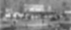
RMWHS Website Images The changing images in the RMWHS website have generated questions -- Who is in that photo? What building is that? When was the photo taken and where? And the most common question: How can I stop the images from changing so I can study them better? To address the questions, the individual images have been provided below with some details and a few links to help you discover more about the Roxborough Manayunk Wissahickon area. If you have more questions about the images, contact us . Likewise, if you can identify any of the faces in the group shots, please contact us . Shawmont Station is the oldest surviving passenger train station in America. Built in the 18 20s , the building became a train station a decade later and was in use until 1991 and was whistle stop until 1995. In 2008, Shawmont was placed on Philadelphia's Register of Historic Places, as the oldest passenger railroad station in America. Owned by SEPTA, the unused building fell further into disrepair until January 2023 when $1.2M of structural renovations began. For more see the Shawmont Station historic profile in our Local Landmarks section. Valley Green Inn , built in 1850, is one of the most recognizable buildings in the area as photos of it grace many local interest and travel sites. Originally it was named Edward Rinker's Temperance Tavern after the man who built it in 1850. Today, Valley Green is one of the last remaining roadhouses and taverns that had once dotted the banks of the Wissahickon in the 19th Century. Pencoyd Iron Works 1884 - This photo was donated by the family of George Maurice Miller (Miller is standing on far left in a short hat with beard and mustache). Born in 1864, Miller graduated from Lehigh University at the age of 16 in 1880. He was approximately 20 years old in this photograph. Miller was said to have been a very hard worker. On November 14, 1900, he purchased the building near the intersection of Ridge, Righter & Hermit from the Adams family to live in. The house had formerly served as a City Poor House. This image of the Schuylkill Bridge was taken during construction in May 1925. It is one image in a series currently on display in the RMWHS Archive. Other photos in the series include the stripping beam forms, removing the centers, the underside of the bridge, and a group shot of the construction crew and other team members. The crew shot is a particular favorite of visitors to the Archive for the clarity of the image, range of expressions, and the playfulness of one prankster in the group. The Rag Girls at Hamilton Paper Mill were responsible for sorting old clothing, sailcloth, ropes and other bits of discarded fibrous materials that were used in the production of paper. The sorting of these "rags" directly determined the type and quality of paper that was made in any given batch. It was a dirty and sometimes dangerous job as the materials sorted could carry germs, disease, and pests. Can you identify anyone in this photo? If so, please let us know. This Restaurant was located at 4147-49 Main Street Manayunk which became the New Umbria Baptist Church following the church's move from Umbria to Main Street several decades ago. While the brick front was refaced with white stucco long ago, the distinct arched window and door openings remain to this day as does the keystone accent featured at the top of each rounded arch. The Roxborough Reservoir Preserve (formerly Upper Roxborough Water Reservoir) on Port Royal and Lare provided this most tranquil view in March 2020. The 35-acre water basin was created in the 1880s to supply water to the growing Roxborough population but today is a nature preserve and part of our city's park system. A trail circles the preserve and is enjoyed regularly by walkers, bikers, birdwatchers, and photographers alike. To learn more about the history and the transformation, see the RDC's 2019 news story: Roxborough Reservoir Preserve is One of Philadelphia’s Hidden Gems . This image of the Main Street Market in Manayunk is dated to the 1920s as was determined by the bags of salt located behind the clerk. This particular brand only used that label in the early 1920s. Little else is known about this market, the clerk, or the reason he posed for the photo. Like the image below, the section shown here accounts for less than 1/4 of the original photograph. It was cropped tightly on the clerk and counter to allow us to show the detail of the scan. The full-size scan allowed archivists to study the products on the shelves and estimate the date the image was taken. Chas. E. Lentz Garage was located at 6655 Ridge Avenue. This image is only a small part of the original photo and accounts for about 1/4th of the overall image. The full photo shows cars parked along Ridge Ave on the left. And to the right, much of the house is visible. However, like the photo above, the the drastic cropping of the original image was necessary to highlight the details. In fact, the scan of this image is such a high quality, the bolts on the wheels are visible when it is viewed at full size. The William Levering School was built as a one room school house in 1748 and named for the man who donated the land. The first school was built of logs and was used not only for a school, but also for a church and political meetings. The school expanded and was rebuilt a number of times, but William Levering School was finally closed in 2013, after 265 years of educating the children of our community. Can you identify anyone in this photo? If so, please let us know. We appreciate your feedback. Contact us.
- RMWHS | Yearbook Project
Community Yearbook Project Yearbooks available to view: 2023 2022 About this project: RMWHS needs your help capturing images of our neighborhoods as they are today . We can all see how quickly things are changing, buildings disappearing, new ones going up. While change can be good, not capturing the evolution of the neighborhoods around is not. We want to capture images ON AN ONGOING BASIS so we can preserve a record of what came before for the future. WE NEED YOUR HELP You may already have some great photos of the 21st Ward on y our phone. You could have photos of the street you live on, a favorite local park, a historic landmark, local festivals, your holiday block party, a flooded Main Street or snow-covered Ridge Ave -- they could all be great additions to the yearbook. If you have a photo that captures something special about our area, an event, the people, building or landmark, canal or bridge, we'd love to see it. Email it to us at RMWHSarchives@gmail.com Photos shared with RMWHS will be consider image donations. Please include your name and a few details about the photo -- such as a street or event name especially if it is not obvious -- so we can put a description on the photo. Keep in mind these should be photos you have taken -- not photos you found on Facebook that you are passing along. Any age is welcome to submit photos. If your kids took some great shots -- feel free to send them in with their name. We will record them as the photographer and it will become part of the RMWHS Digital Collection. There is no "deadline" on this request. RMWHS is always interested in images of the 21st Ward -- new or old. Note: All photos are reviewed by RMWHS archivists to ensure they are appropriate for display and incorporation into the permanent RMWHS Image Collection. Please not send images that you didn't take. Your photos can become a part of our collection -- your photos can become part of our local history. Of course! We will post old photos in too -- we did in 2022, go take a look. Whatever we receive in a specific year will be posted within that yearbook. We have even received an entire collection of old photos (see 2022's Blair Family Collection). Will you take old photos too Email your photos or scans to RMWHS.
- RMWHS | RARHD | Gothic Revival Architecture
Ridge Ave Roxborough Historic District Gothic Revival Architecture The picturesque Gothic Revival style was popularized by landscape architect Andrew Jackson Downing’s Cottage Residences, first published in 1842 and reprinted in many editions in the mid and late nineteenth century. In the eighteenth and early nineteenth centuries, American architecture styles, including Georgian, Adam, Federal, and Greek Revival, were predicated on Classical forms and vocabulary. In the early nineteenth century, as industry grew, rural areas transitioned into suburbs, a middle class emerged, and the field of architecture was professionalized in the United States. Those architects proposed a new architectural vocabulary appropriate for housing in suburban environments. In 1837, architect Andrew Jackson Davis (1803-92) published Rural Residences, in which he drew from British sources to champion the Gothic Revival style for domestic architecture for the first time in America. Rural Residences was influential, but the Gothic Revival style for American domestic architecture was catapulted into collective national consciousness by landscape architect Andrew Jackson Downing (1815-52), a friend and collaborator with Davis, who published A Treatise of the Theory and Practice of Landscape Gardening (1841), followed by Cottage Residences (1842), and The Architecture of Country Houses (1850). In his books, Downing popularized the modest-sized, inexpensive detached cottage in a suburban or rural setting. Downing’s pattern books provided multiple design suggestions for this type of dwelling, ranging from a small suburban cottage to a villa in the Italian style. By the mid-1840s, the picturesque Gothic or Gothic Revival style of architecture began to increase in popularity for residences, largely due to Downing’s pattern books. Downing’s Cottage Residences is considered “one of the most widely used books in American architectural literature.”80 Downing’s The Architecture of Country Houses, a companion to Cottage Residences, has been called a “seminal” book in American architecture. According to the National Historic Landmark nomination for the Rotch House, a Gothic Revival house in New Bedford, Massachusetts designed by Davis in 1845, “the publication and eventual dissemination and popularity of Downing’s Country Houses became a watershed event in the evolution of American domestic architecture, and today cultural historians recognize the book’s significant consequences for the shaping of popular taste in the pre-Civil War period.”81 While his books included many details of house and landscape designs, Downing provided the designs as suggestions, which a builder could adapt to the site and the needs of the homeowner. Downing’s books, in collaboration with Davis, who provided many of the architectural designs and illustrations, inspired the design of numerous cottage residences in rural and suburban settings, leading to an era characterized by these types of Victorian cottage residences. A rural, rather than urban, setting was considered important to the Gothic Revival style, as the building was intended to be compatible with the natural landscape, not situated on a narrow urban lot.82 The primary distinguishing characteristic of the Gothic Revival style is the centered cross gable roof with decorated barge boards. Other characteristics include finials, steeply pitched roofs, pointed arch lancet windows extending into the gables, and open entry and full-width porches with flattened, pointed Gothic arches. One of the best examples of the Gothic Revival style in Roxborough is the Amos Barnes House at 559 Righter Street, at the intersection of Ridge, Righter, and Hermit. Constructed of Wissahickon schist about 1856, the Barnes House effectively represents the Gothic Revival style with Victorian Cottage elements, as reflected in the center cross gable decorative barge board at the roofline. Originally, the building had a full-width front porch and lancet window at the gable (Figure 29). Other excellent examples of the Gothic Revival style on Ridge Avenue include the houses at 5508 Ridge Avenue, which includes the centered cross gable, arched gable windows, and full-width front porch; and 8029 Ridge Avenue, which includes the centered cross gable, lancet windows, and a highly ornamented, full-width, front porch. The building at 8029 Ridge Avenue is unique in that it is clad in wood shiplap siding rather than masonry. Also, rather than decorative bargeboards, it has bracketed cornices, linking it to the Italianate style as well. Describe your image This information has been posted by RMWHS with the permission of the Philadelphia Historical Commission. Sections: 1 Intro and Nomination Form 2 Boundary and Description 3 Statement of Significance 4 Native Americans 5 Patent Holders and Early Settlers 6 Ridge Road 7 Early Roxborough 8 Georgian and Colonial Architecture 9 During the Revolutionary War 10 Federal Architecture 11 Development of Manayunk 12 Greek Revival Architecture 13 Early 19th Century 14 Gothic Revival Architecture 15 Italianate Architecture 16 During and After the Civil War 17 Second Empire Architecture 18 Queen Anne Architecture 19 Turn of the Century 20 Conclusion and Bibliography 80 Adolf K.Placzek, “Preface to the Dover Edition,” in Andrew Jackson Downing, Victorian Cottage Residences (New York: Dover Publications, Inc. 1981), p. iii. 81 Peggi Medeiros and William E. Krattinger, National Historic Landmark Nomination for William J. Rotch Gothic Cottage, designated February 17, 2006, p. 9. 82 Leland M. Roth, A Concise History of American Architecture (New York: Harper & Row, Publishers, 1979), p. 100-103; Virginia & Lee. McAlester, A Field Guide to American Houses (New York: Alfred A. Knopf, 1993), p. 200. Top of page
- RMWHS | Research Assistance
Research Assistance Our volunteer archivists Sylvia Myers and Georgie Gould may be able to help you with: a general local history question a specific genealogical question questions about RMWHS Please use this form to contact us for: Leverington Cemetery burial locations Roxborough Baptist Churchyard burial locations General local history questions & info Requesting Archive info &/or appointments Genealogical Research We will not undertake your family history for you -- but we may be able to help you with one or two specific a questions that involve local individuals or history. Please be sure to be very clear and concise in your question, and provide the information necessary to hunt for an answer in the Archive. (Think who, what, where, when.) NOTE: The Archive is not computerized. All research is done old school by looking through books, files, photos, maps, manuscripts. The time it takes can be significant. Please allow for a significant wait time -- there are always requests in the queue. Donations for our efforts are appreciated. All donations will be used to preserve and improve the Archives. Sylvia Myers Georgie Gould
- RMWHS | Meetings & Events
Meetings & Events Beginning in 2023, the RMWHS calendar will be designed to provide a mix of in-person and Zoom-based meetings, events, tours, activities, etc. The date, time, location, and format of the meeting will vary. This less rigid schedule is a departure from our traditional calendar and was designed to allow us more flexibility so we are able to align our activities with community events, venue and speaker availability, museum hours, host organization scheduling, and other opportunities we might otherwise miss. Efforts to live stream in-person events via Zoom and/or record for replay options will be made within reason. Some meetings and events on the schedule will be specifically designed and planned for a Zoom virtual meeting. There are some topics that will better lend themselves to this format like a presentation with photos, videos, or an interactive feature such as surveys, quizzes, or voting. The RMWHS calendar will be updated as needed. Additional notices and updates will be directly mailed and/or emailed to current members. If you wish to get notifications about RMWHS activities, we'd love to have you as a member. Membership fees are modest and the monies raised support our ongoing efforts to preserve and promote local history, art, and culture. For more information about the calendar, membership, or if you'd like to speak or present to the group, please contact us. Georgie Gould, President, RM WHS Go to RMWHS Calendar > Masks Optional at Events Masks are CURRENTLY OPTIONAL for all in-person gatherings UNLESS ou r host organization or locatio n requires we wear them. If you are planning to attend an event/meeting in-person, please bring a mask along just in case something changes or you decide you wish you had one. Note: If you wish to wear a mask at ANY gathering -- please do! You will not be alone as some of us always do (including the president) . Masks Required at RMWHS Archive Currently visitors ARE REQUIRED to wear masks in the RMWHS Archive due to the size of the room. If you are not willing -- or are unable -- to wear a mask, please request a virtual or phone consultation. We currently offer FaceTime, Zoom, Skype, and Google Meet.
- History Hub | RMWHS
RMWHS History Hub Sections below will grow, merge, and change as additional content is added and this website evolves. Topics to Explore Historic Districts Images & Image Collections Artists & Authors Maps & Self-Guided Tours Topics to Explore Up Memorials of the 21st Ward Discover Houses of Worship This section is in development Local Landmarks Discover We have more topics to write about and welcome volunteer assistance. Contact us to learn more. Our Historic Districts Up Ridge Avenue Roxborough Historic District Discover Main Street Manayunk Historic District Discover Upper Roxborough Federal Historic District This section is in development Victorian Roxborough This section is in development Images & Image Collections Up RMWHS Web Images - Details Revealed View the individual images used on the RMWHS website, get the details, and learn more about our local history. Explore Port Royal Horse Stable A beautiful image collection of horses, riders, events, and playful moments at the farm. Discover Artists & Authors Up Claude Clark World-Renowned Artist, Educator, & Roxborough High School Graduate Celebrate We have more topics to write about and welcome volunteer assistance. Contact us to learn more. Maps & Self-Guided Tours Up Historical Maps Explore 1304 Steps of Our Town Explore
- RMWHS | Spotlight: Claude Clark
In the Spotlight Claude Clark Artist, Poet, Author, and Educator Does the name Claude Clark ring a bell? He's a Roxborough High School graduate that made it big in the art world and whose paintings can be seen in museums from our local Woodmere Art Museum to the Smithsonian and the Metropolitan Museum of Art. Born in the South, Claude's family moved to Philadelphia in 1923 to escape poverty and the Ku Klux Klan. They settled in Manayunk to be close to relatives that lived in the area and became members of the Josie D. Heard A.M.E. Church. Claude attended Roxborough High School and was the only black graduate in June 1935. While attending Roxborough High School, Claude spent Saturdays attending art classes in Center City. His talent was recognized by the school principal, who recommended him for a scholarship so that he could further his artistic talent. Click newspaper image below to open a larger version. The Philadelphia Inquirer, April 30, 1944 RMWHS Celebrates Black History Claude Clark November 11, 1915 - April 21, 2001 Claude Clark Portrait - Wikipedia "As a child in the churches, the schools and the community, I dreamed of a destiny. My search became a single purpose for the dignity of Black Americans..." - Claude Clark Treasure Trove of Information www.claudeclarkart.com offers an exceptional collection of information on Claude Clark including downloadable PDFs that are a must-see for those wishing to learn about the artist. It is well worth the visit. Claude went on to attend the Philadelphia Museum School of Art and later pursued studies at The Barnes Foundation in Merion, Pennsylvania, where he met and became friends with Albert C. Barnes . While there were relatively few celebrated black artists during the artist's early years, he reached out to renowned painter Horace Pippin , who became a friend until Pippin's passing in 1946. “Freedom Morning” by Claude Clark was painted in 1944 by Claude Clark. It was painted in Philadelphia and commissioned by the Philadelphia Symphony Orchestra. Throughout his life, Claude mentored black artists and black causes. He became an outstanding art professor and educator, working toward advancing art education and recognition of black artists. Today his work is displayed in museums across the country and abroad as well as in the homes and the rich and famous. "A Dreamer" by Claude Clark at the Woodmere Art Museum in Chestnut Hill. The Roxborough Manayunk Wissahickon Historical Society holds a large repository of information about Claude Clark's life, including poems, short stories, family photos, and of course examples of his artwork. Many of these items were donated to the RMWHS by close friends of the artist. Clark never forgot his local roots and his works of art reflect that love. "Resting" by Claude Clark at the Smithsonian American Art Museum Gift of the Harmon Foundation This oil painting on canvas was created in 1944 and is in the Renwick Gallery of the Smithsonian American Art collection in Washington DC. You are invited to explore the links provided below to discover more about Claude Clark, his life, his talents, and his accomplishments. LEARN If you would like to learn more about Claude Clark, visit the RMWHS Archive . VIEW If you would like to view Claude Clark's artwork in person, plan a visit to the Woodmere Art Museum and the Philadelphia Museum of Art . Note: Always check with a museum before a visit to verify the works/artists you wish to see are on display and not out on loan or unavailable due to restoration, remodeling, or a visiting exhibit. EXPLORE Want to see more from the comfort of your home? Explore examples of Claude Clark's artwork online right now! www.claudeclarkart.com Woodmere Art Museum Philadelphia Museum of Art Smithsonian Metropolitan Museum of Art RMWHS's In the Spotlight features local artists, inventors, writers, poets, scholars, activists, leaders, thinkers, and other individuals who have had an impact on history. RMWHS has a long list of people we plan to feature, but we'd love to hear from you -- is there someone you'd like us to feature? If so, let us know . RMWHS thanks our special contributor Donna Howley for helping us honor Claude Clark.
- wwi-wwii-hattal-taylor
< Back to Memorials List WWI & WWII Memorial (Hattal-Taylor VFW) Address: 376 Lyceum Ave, Philadelphia, PA 19128, USA Visitors: This memorial is located outside the Hattal-Taylor VFW and can clearly be seen from the sidewalk and street. If you wish to gain closer access, contact Hattal-Taylor. The images below are not to be reproduced or used without prior written authorization of RMWHS - contact us .
- RMWHS | MSMHD | Description
Main Street Manayunk Historic District Description The Main Street Manayunk National Historic District is located on the north bank of the Schuylkill River, approximately 5 miles northwest from the center of Philadelphia. The community of Manayunk has retained a strong individual physical identity. Geographically, Manayunk and the adjacent communities of Roxborough and Wissahickon are separated from other sections of Philadelphia to the east, by the steep ravine of the Wissahickon Valley. Main Street is located within the narrow flood plain of the Schuylkill. North of Main Street, the topography rises steeply to Ridge Avenue on the crest between the Schuylkill and Wissahickon. Because of the geographical and cultural isolation of Manayunk, the physical appearance of the townscape and individual buildings differs markedly from those of similar eras built in other sections of the City. While Philadelphia residential and commercial buildings are typically red brick, those of Manayunk are commonly constructed of random coursed stone, Wissahickon Schist, either exposed or faced with stucco. It is the combination of steep topography, and white painted, pitched roof, stucco row houses which epitomizes the physical character of Manayunk. Describe your image The clear hierarchy of land use developed in Manayunk followed construction of the canal. The principal mill buildings were located on Venice Island between the Schuylkill River and Canal, though many of the major mills had operations on both sides of the canal, linked by bridges; often mill offices were located on the south side of Main Street. In contrast, commercial uses -- such as offices, hotels and banks, and mixed residential/ commercial buildings tended to concentrate on the north side of Main Street. Residential construction, typically in the form of attached 2- or 3-story row houses occurred on the side streets off the north side of Main Street. While the earliest development consisted of mill buildings and worker housing, later 19th century development included a broader range of commercial uses, including banks, warehouses, and retail stores, particularly at the west end of Main Street, corresponding to Main Street's developing role as a full retail and business center. Little development or redevelopment occurred in Manayunk after the turn of the century, and the overall physical appearance of the Main Street historic district has changed little since this time, although many retail and business uses have been replaced with lower grade warehouses, and storage uses. The earliest buildings remaining in Manayunk are mills of the 1840s and 1850s, and worker housing of the same era. Several of these mills remain on the Main Street side of the canal, at the east end of Main Street. The finest remaining mill building within the historic district is that located at 4268-72 Main Street, originally known the Blantyre mill. The two, 3-story pitched roof buildings, set at right angles to Main Street were constructed in 1847, of random stone rubble, with cut stone quoins, and brick arches over the window openings. An unusual feature are the fanlights in the gable ends facing Main Street. Describe your image Other important early mills include a 2-story building at 4050 Main Street, constructed about 1850 (originally the Roxborough Mills), a 4-story building at 4100 Main Street (formerly the Dexter Mills - dyeworks) and the rear buildings are facing the canal at 4208 Main Street (formerly Economy Mills). These buildings are typically long, narrow span structures of random stone rubble, often with a later stucco facing, and shallow pitch roofs. Window openings commonly have brick arch lintels, while windows are typically wood, arched head double hung with 4/4 or 12/12 lights. Another noteworthy loft building located on the north side of Main Street at 4313 in a 3-story, 6-bay structure built in 1859 of Wissahickon Schist. The building has segmentally arched brick labels over each window, and wood double hung windows. Describe your image Examples of housing of this era remain, both on Main Street, and on the narrow side streets. The housing is utilitarian, working class attached housing, Vernacular in style, although exhibiting distinct characteristics of formal design styles. The earliest housing is typically constructed in a Vernacular Federal style, while later housing is of a Vernacular Italianate style. The earliest remaining residential buildings are located at 104-106 Levering Street, constructed about 1840. These are 3-story, 2-bay, Federal style, stucco over stone rubble, pitched roof structures. The 2nd floor windows are double hung wood with plan frame, and the 3rd floor windows are casements. 103-105 Pensdale Street is a group of small Vernacular style worker houses built circa 1860. Built of stone rubble faced with stucco they have double hung 2/2 arched head windows and decorative wooden cornices. In contrast to the early simple random stone and stucco mills, later commercial buildings are commonly of brick, exhibiting the richer detailing typical of the late Victorian era, and are similar to such buildings in Philadelphia Some of these later buildings were manufacturing facilities, but many reflected the increasing importance of Main Street as a business and retail center. The finest example of a later industrial building is 4236 Main Street, an elegant 3-story, 3- bay brick loft constructed about 1890. The 1st-floor storefront incorporates a cornice, and central entrance flanked by pilasters. Crowning the building is a heavy wood cornice. 4346 Main Street is the former Manayunk Trust Company building, a monumentally scaled, single story banking hall, built in 1890. Constructed of brick, the building has pilasters with decorative capitals and consoles, stone cornices, and monumental scale windows with a stone surround enhanced with Greek key design. 4360 Main Street is a heavy 3-story, 5-bay brick warehouse constructed about 1890. The Romanesque detailing includes paired semi-circular headed windows on the 3rd floor, Palladian style 2nd floor windows, brick pilasters and a molded tin cornice. A similar style 2-bay, 4-story Romanesque style brick warehouse is located on 108-12 Levering Street. Noteworthy retail buildings include 4356 Main Street, an elegant 2-story building of 1880, featuring extensive use of glass. The ground floor consists of large storefront windows and recessed entrance way, with decorative metal transom panels above. The 2nd floor has large, fixed sash with transom lights, metal faced dividing mullions, and molded metal cornice. Describe your image Finally, there are some interesting turn of the century commercial buildings. 4437 Main Street is a handsome single story brick bar built in 1903. The facade incorporates a decorative ogee arch stepped brick gable parapet, with metal trim. 4323-24 Main Street, the Nickles Building of similar date, is a 2-story, 2-bay brick retail store with elegant, curved glass display windows, and a large ornate metal cornice and parapet. Describe your image This information has been posted by RMWHS with the permission of the Philadelphia Historical Commission. Sections: 1 Intro and Nomination Form 2 Description 3 Significance of Manayunk 4 The Schuylkill Canal 5 Schuylkill Navigation Company 6 Manayunk Canal 7 Economic Development 8 Manayunk Social Development 9 The Industry of Venice Island 10 Main Street Manayunk 11 Bibliography 12 Boundary Details 13 Map Top of page
- RMWHS | RARHD | Federal Architecture
Ridge Ave Roxborough Historic District Federal Architecture The Federal style of architecture, which emerged after the Revolutionary War, is closely related to the earlier Georgian or Colonial style, but Federal buildings are lighter and more delicate than their predecessors, which were generally weighty with stout detailing. Like the earlier houses, Federal houses are generally side-gabled, two-story, symmetrical boxes. Wissahickon schist remained the predominant building material, but the stone was sometimes faced with stucco. The Federal style was employed in Roxborough Township from the 1780s through the 1820s. The Levering-Jones House at 6341 Ridge Avenue, which also served for a short time as the General Washington Tavern, is an excellent example of the Federal style (Figure 20). Built about 1796 by William and Martha Levering, the house was converted to a tavern in the early nineteenth century. It was later converted back to a residence and was the boyhood home of prominent historian Horatio Gates Jones Jr. The house was restored to its original appearance in the twentieth century. Its side-gable, symmetrical façade, pedimented door surround, and pedimented dormers with Gothic windows are all hallmarks of the Federal style. The Starne-Smick House at 7552 Ridge Avenue, built about 1795, is another good example of a Federal style house in Roxborough. Although without the high-style embellishments of the Levering-Jones House, the Starne-Smick is a large, well-preserved, significant example of the style. The Joseph Ozias House of 1811 at 7953 Ridge Avenue is another example of a well-preserved Federal style house. The cut-stone front façade with quoins at the corners is an interesting feature of this otherwise modest residence. Describe your image This information has been posted by RMWHS with the permission of the Philadelphia Historical Commission. Sections: 1 Intro and Nomination Form 2 Boundary and Description 3 Statement of Significance 4 Native Americans 5 Patent Holders and Early Settlers 6 Ridge Road 7 Early Roxborough 8 Georgian and Colonial Architecture 9 During the Revolutionary War 10 Federal Architecture 11 Development of Manayunk 12 Greek Revival Architecture 13 Early 19th Century 14 Gothic Revival Architecture 15 Italianate Architecture 16 During and After the Civil War 17 Second Empire Architecture 18 Queen Anne Architecture 19 Turn of the Century 20 Conclusion and Bibliography Top of page

